The Future of the Whitewater Valley Conservation Society

The future constitution of the Whitewater Valley Conservation Society, as informed by the letter from the Chairman in advance of the Annual General Meeting of 3 December 2023, can be summarized as follows.

Historical Context

The Whitewater Valley Preservation Society was established in the late 1970s to combat proposals for dredging the River Whitewater for gravel. The Society has since been involved in various activities, centered around the conservation of the chalk stream and its valley.

Constitutional Issues

By the early 2020s, the Society’s original constitution was deemed inadequate for current needs. It was a loose association without a legal entity, which brought limited structure, minimal presence, and potential personal risk to members due to increasing regulation and compliance requirements.

Key Reforms

Establishment of Legal Entity: The absence of a legal entity made members jointly and severally liable for the Society’s actions. To mitigate this, the Committee sought legal advice to address the issue.

Achieving Charitable Status: The lack of a separate legal entity also meant the Society could not attain charitable status, which had financial benefits for both the Society and its members. Establishing charitable status was seen as a means to grant the Society more substance, authority, and credibility.

Incorporation and Charitable Status

Following the advice from specialist solicitors, the Society formed a “Community Benefit Society” named the “Whitewater Valley Conservation Society”, which was registered with the Financial Conduct Authority. However, achieving charitable status also required confirmation from Her Majesty’s Revenue and Customs, which was granted after two years.

Current Status

The transformation gained unanimous final support and approval, following a strong turnout for the vote, from the contributors at the AGM on 3 December 2023 at the Cross Barn, Odiham.

The new Whitewater Valley Conservation Society now operates as a separate legal entity with charitable status, having its own bank account and is set to continue the work of the former Whitewater Valley Preservation Society.

Acknowledgments

The Society commends the efforts of and thanks the Chairman, Candy Burnyeat, Andrew Soundy for legal oversight, and Hon Treasurer Rupert Wiggin for their roles in navigating the Society to its new status.

Sewage spillages into the River Whitewater

Thames Water Holt Lane sewage discharge map

Constructor damage to pipeline at Sainsbury’s site, North East Hook

The Whitewater Valley Preservation Society (WVPS) expressed concerns when the development of 500 houses on a site in North East Hook, adjacent to the roundabout on the A30, was first considered by Hart District Council.

The main reason for our concerns was the fact that the entire site sits on a slope (the West side of the river valley) which exposes the river not only to run-off from construction but, once built and sold, problems with the sewage generated by the site, given the lie of the land.

During the construction phase, there were indeed incidents of pollution to the river, despite assurances from Hart, and now the entire sewage system is reliant upon pumping of effluent into tanks on the site when the Thames Water network cannot handle the flow.

Whilst touring various pumping stations susceptible to sewage discharge recorded on the Thames Water sewage discharge map, WVPS committee member John Fleming, visited Holt Lane. Here it was apparent that flooding was occurring in the field next to the River Whitewater.   A Thames Water engineer informed Mr Fleming that builders on the Sainsbury’s site had damaged a sewage pipe carrying effluent to the storage tank on site. Thus putting all of the houses at risk of flooding with sewage effluent from the damaged pipeline.

The only solution available to Thames Water was to divert many tankers to the location of the damaged pipe, to collect the effluent and transport it to the Holt Lane storage tanks.

Holt Lane pumping station links into the system leading to Hartley Wintney treatment works, but at times of heavy rainfall, the system is overwhelmed and effluent must be stored until capacity is available.

Since Holt Lane is known to need tankers to avoid having to discharge into the river, in these heavy rainfall conditions, the problem at Hook will inevitably lead to discharge into the Whitewater.

WVPS Chairman, Candy Burnyeat, and Mr Fleming feel this is sufficiently important for members to be informed and to write to the new Chief Executives of Hart and the Environment Agency.

WVPS believes there should be a full investigation into and report on the damage caused to the river, and actions proposed to alleviate the environmental impact on its chalk stream ecology.

The working of the current system and its reliance on holding tanks, especially in view of the changing climate and therefore weather patterns, should be the subject of an urgent review. There is a need to increase the capacity of the wastewater system to Hartley Wintney, thereby removing the constant danger of effluent discharging into to River Whitewater.

Her Majesty The Queen

The members of the Whitewater Valley Preservation Society are deeply saddened at the death of HM Queen Elizabeth II.

Our thoughts and prayers are with the members of the Royal Family at this sad time.  

God save the King.

Police BARN MEET for Hart Rural

You are invited to attend a Police BARN MEET for Hart Rural – this coming Thursday 3rd February at 6pm at Rotherwick Village Hall.

It’s aimed particularly at those involved in the rural economy, who are likely to be involved with / interested in, rural policing.

So landowners, gamekeepers, farmers, other rural businesses or interest groups – or anyone with horses – noting one of the key speakers is Rachael Terry, equine liaison.

Heckfield Parish Council is ‘supporting’ the event by booking the venue and helping to promote it.  This event was originally booked for Highfield House in January, but a late change of date and time meant we also had to change venue – hence Rotherwick Village Hall.

The Police BARN MEET poster, together with one which has a bit more background are attached. barn meet-Rotherwick-3rd Feb-

If you are interested in attending, please if possible let the Clerk at Heckfield Parish Council know by email to [email protected].

Bunkers Hill solar farm

21/00552/FUL Solar Farm and battery stations together with all associated works, equipment and necessary infrastructure

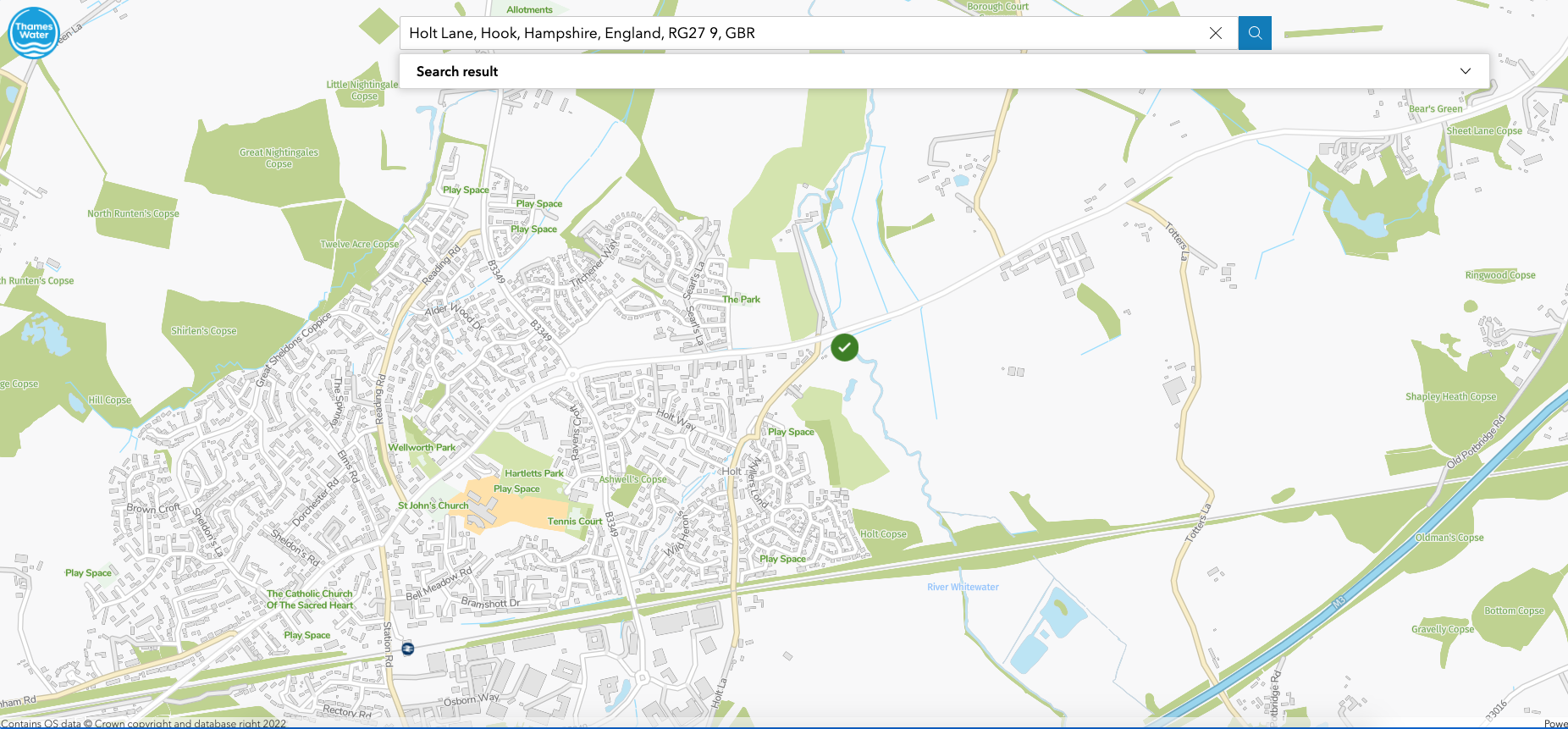
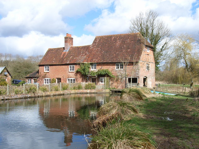
Bunkers Hill Farm, Reading Road, Rotherwick, Hook, Hampshire RG27 9DA

Overview

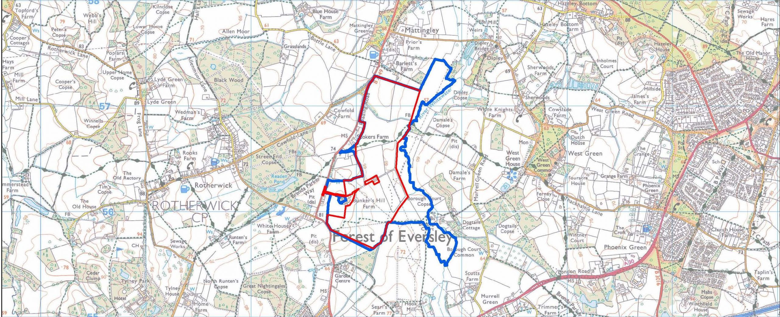
JBM Solar is proposing a photovoltaic solar farm on land at Bunkers Hill Farm.  The proposal would cover approximately 200 acres of Grade 3b agricultural land and deliver up to 50MW renewable energy.  The site runs alongside the River Whitewater, with solar panels for the next 35+ years.  We encourage you to look at the developer’s website to see the location of this proposal, also shown on the map above.

This is one of four current proposals for large solar farms in the Whitewater Valley, and one of five in very close proximity in the vicinity of Hook, North-East Hampshire, all of similar size and capacity.  Each of these three proposals is just below 50MW, because over that capacity, they would be designated as nationally significant infrastructure, which would require consent of the appropriate Secretary of State.

The site proposed is:
  • Green belt (currently grade 3b farmland) of approximately 71 Ha
  • The site is within the parish of Rotherwick and the location impacts the parishes of Mattingley, Hook and Hartley Wintney
  • The location is bounded approximately by Bartlett’s Farm to Hook allotments (North to South) and the B3349 to River Whitewater (West to East).  

Landscape character and type

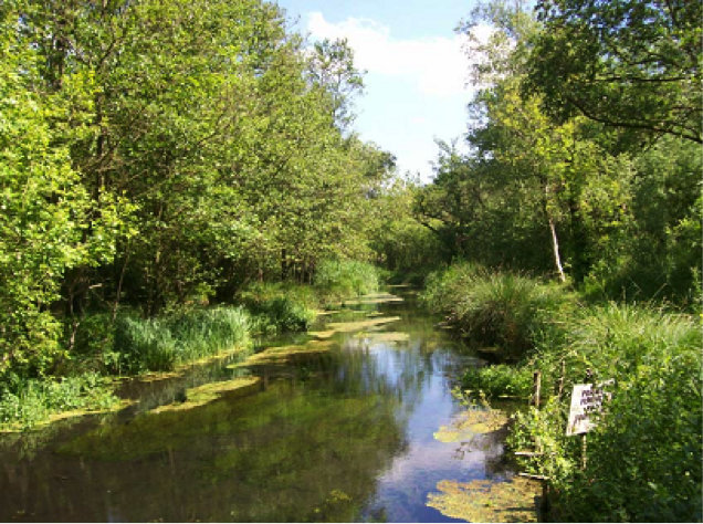
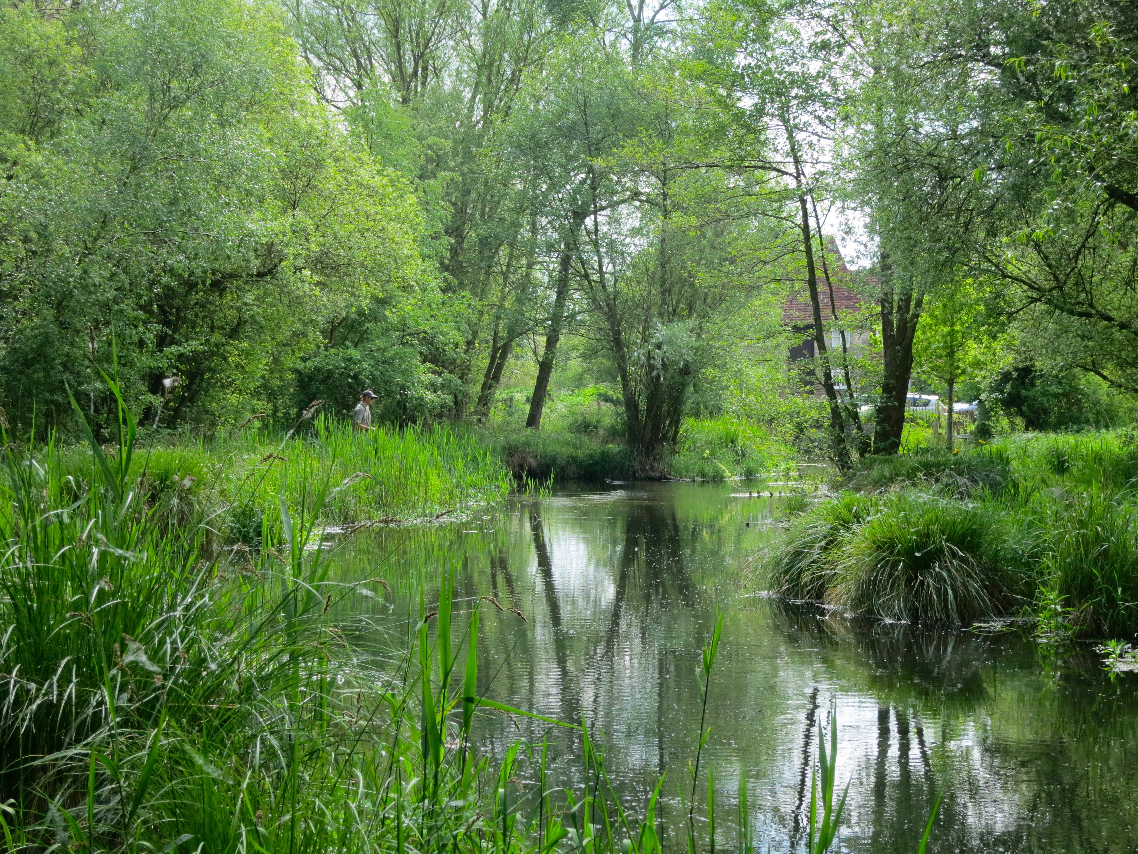
The Bunker’s Hill proposed development is located on a greenfield site, on the western valley sides of the Whitewater Valley, on gently undulating land.  

As noted in Hart’s report on the EIA screening (20/01807/EIA) the site is within the Whitewater Valley Landscape Character Area.  This proposal would introduce built development on a greenfield site over a significant area.  The proposed development would change the visual appearance of the area and result in some impact upon the landscape.

Hart’s Landscape Character Assessment (1997) identifies the Whitewater Valley landscape character area as within the Open Arable Farmland landscape type.  Hampshire’s Integrated Landscape character assessment (2010) classifies the site as falling within Lower Mosaic Open landscape type.

Rights of way

The site has a sloping topography and is part of the valley for the River Whitewater with varying degrees of visibility from Reading Road. There are three public rights of way (PRoW) that cross the site:

  • PRoW16 running north/south through the northern part of the site then past Barlett’s Farm;
  • PRoW17 running east/west through the central part of the site past Neville’s; and
  • PRoW23 running east/west across the southern part of the site south of Bunkers Hill Farm.

In particular, the Brenda Parker Way long distance route runs between Andover and Aldershot.  This route connects Tylney Park with the river valley and West Green Conservation Area in the east.

Other footpaths provide circular routes from centres of population into and across the Whitewater Valley landscape.

The use and value of these routes increased dramatically in 2020-21 and has remained high with many residents now working from home.

Landscape and visual impact

Landscape impacts may be confined to the site, whilst visual impacts would be wider.  Coverage of the site would be over a large area but at low level.  These impacts would be reduced through the retention of landscape features such as trees and hedges, although any such mitigation measures would likely vary in effectiveness given seasonal changes in foliage.

Therefore it is important o fully assess impacts on landscape and visual amenity through a comprehensive Landscape and Visual Impact Assessment, particularly in relation to public views from the PRoWs.

Local communities value the recreational resource, which the river and valley provides.  So it will be important that the Landscape and Visual Impact Assessment (LVIA) provides a comprehensive set of representative viewpoints.  These include assessment of effects from other key features, such as heritage and nature conservation assets, particularly where they contribute to sense of place and special qualities of the river and landscape more widely.

The proposed development includes a number of features, which can give rise to landscape and visual effects, in addition to the photovoltaic arrays.  Ancillary development, such as fencing and CCTV posts, can also have an urbanising influence on the landscape.

Deer fencing in an area heavily populated by deer and in a council named after the deer (Hart) is of particular concern.

The current proposed layout does not detail the position of inverters (other than the central inverter), CCTV poles, storage container(s), access arrangements, delivery station or the location of the construction compound.

We would expect the LVIA to consider the effects of all aspects of the proposed development.  This includes during construction, operation and in relation to the potential for solar glare.

Local plan

Local Plan Policy NBE2 – Landscape is relevant to the proposed application.  It states that ‘development must respect and wherever possible enhance the special characteristics, value and visual amenity of the District’s landscapes.  This should be done with reference to the Hart District Landscape Character Assessment, visual amenity and scenic quality of the landscape and other identified criteria.’

There is increased recognition of the value of landscapes in terms of Local Plan Policy, local communities (as reflected in the Hook Neighbourhood Plan) and National Planning Policy (Para 170).  Given this, we request that the LVIA includes a detailed assessment of landscape value of the Whitewater Valley, which will be affected by the proposed development.

Whitewater Valley Preservation Society response

The Whitewater Valley Preservation Society submitted its WVPS comments re Bunkers Hill Solar Farm objection to Hart District Council on the full application for a solar Farm at Bunkers Hill, Rotherwick, Hook RG27 9DA. 

Our analysis of the application revealed that the applicant has failed to meet the pre-application advice provided.  The applicant failed to provide thorough, rigorous assessments of the effects on Landscape, Public Rights of Way (PRoW), Heritage Assets and Ecological impact.

The Society’s thorough reviews of the developer’s assessments reveals the true extent of damage that would be caused by this proposal.  The reviews also demonstrate that the application fails to comply with Hart’s policy requirements and, therefore, fails to satisfy the basis on which the application could be approved.

In conclusion, the Society believes this development would have a significantly negative impact on the Whitewater Valley.  The development would destroy the valued landscape and historic assets / environment of the Whitewater Valley.  This development – if approved – would change the rural nature of the Whitewater Valley and adversely affect the enjoyment of its landscape by this and future generations.

The Society’s members believe passionately in the integrity of this beautiful section of the Valley.  They are distraught at the damage that would be caused to this idyllic and characteristic lowland river valley by what would be an extremely industrial intrusion of the proposed solar farm and its accompanying paraphernalia.

It is on this basis that the Whitewater Valley Preservation Society objects to the application.  We therefore trust that Hart will refuse this application.

Background to the proposal

  • The full planning application – 21/00552/FUL Solar Farm and battery stations together with all associated works, equipment and necessary infrastructure – was registered on 8 March 2021. To view the application documents and submit your comments, please go online to Hart District Council planning applications , click on “View and comment on planning applications“, and enter 21/00552/FUL in the Search box. The deadline to submit comments to the public consultation was Wednesday, 7th April 2021.
  • JBM Solar conducted a limited consultation on their initial proposals in September 2020. This was publicised by posting leaflets to selected addresses in the Rotherwick area; and initially requested responses from residents within a few weeks. The Whitewater Valley Preservation Society requested that their publicity was extended to a much more appropriate, wider area and an extension to their deadline to Friday, 23rd October 2020. We submitted our response by the extended deadline.  To request a full copy of our response, please email us.
  • A request for screening opinion – 20/01807/EIA – as to whether the solar farm planning application would require a full Environmental Impact Assessment, was submitted on 3 August 2020. Whilst a full EIA was not required, the report noted that:
    • Potential impacts on the River Whitewater (including those from accidents) would need to be fully assessed
    • Given the site area, flood risk zones and that the land immediately adjacent to the river such that the ground is at risk of groundwater flooding, any planning application would require a Flood Risk Assessment and drainage strategy.
    • There may be impacts upon the settings of heritage assets nearby. These include the Mattingley Green and Rotherwick conservation areas and a number of (Grade II and one II*) listed buildings in close proximity to the site boundary. Such impacts would need be considered in a Heritage Assessment.

Riverfly census on the Whitewater

Salmon & Trout Conservation has undertaken a three-year Riverfly Census on the Whitewater.  Their analysis S&TC Whitewater Conclusions final has revealed that the river is in ecological crisis.  The River Whitewater is a chalkstream, one of only about 200 in the world.  The most significant water quality pressures are sediment, nutrient and chemical pressure.

The River Whitewater is currently failing to meet Good Ecological Status as required under the Water Framework Directive.  The main pressures and reason for failure are physical habitat and barriers to fish passage.  This means fish populations are prevented from moving freely through the river.  Such barriers include mills, weirs and culverts.  Physical barriers also impede sediment movement.  They change flow, which can promote build up of fine silts.  Such accumulation alters the natural river form which can impact the ecological status.  Our survey shows evidence of this, with persistent sediment stress being indicated by the invertebrate community.

Land use surrounding the Whitewater shifts from predominantly arable to grassland along the river.  Arable farming, especially when it is undertaken right up to the river’s edge, can contribute high quantities of excess fine sediment to a watercourse.  Crop harvesting and ploughing leaves soil bare and vulnerable to washing off during rain events.  Water friendly farming techniques such as cover crops, buffer strips and zero tillage (where feasible) would benefit the upper reaches of the Whitewater by reducing the sediment load.

Many chemicals, such as pesticides and herbicides used in arable agriculture, bind soil and are delivered to watercourses via sediment run-off.   Chemical stress was indicated at nearly all sites.  A seasonal chemical impact was exhibited by the invertebrate community.  All failures of the proposed Water Framework Directive Species At Risk (SPEAR) standard for chemicals occurred in autumn.

Burrowing from signal crayfish can increase bank erosion and introduce greater sediment loads into the river.  Therefore, it is important not to overlook this as a contributing factor to sediment stress in the Whitewater.  Invasive North American signal crayfish (Pacifastacus leniusculus) were detected at all of the sites monitored in the Whitewater survey.   These crayfish are capable of exerting change in ecological condition to the river both directly, through disease, predation, competition or displacement, and indirectly by disrupting food chain dynamics and altering physical and chemical habitat characteristics.

In 1981 mass mortality of the native white-clawed crayfish (Austropotamobius pallipes) was observed and following this, the species completely disappeared from the Whitewater and Loddon rivers.  Crayfish plague, of which signals are carriers, is suspected as the cause but this is unconfirmed.   Signal crayfish are found most frequently at Hook Mill.  Juvenile signal crayfish recruitment was particularly high at Poland Mill in spring 2019.  A lack of leeches and molluscs found at these sites infers an ecosystem impact from signal crayfish predation.

Taking appropriate measures to reduce the signal crayfish population may benefit the Whitewater’s ecology.  Activities such as trapping will not eradicate populations of signal crayfish, but in some cases can increase the total number of individual macroinvertebrates.

Nutrient stress was less pronounced than sediment stress in the Whitewater at our surveyed sites, but was still indicated as moderate on many occasions.  Excess phosphate entering the Whitewater is likely to be from a combination of sources, including runoff from arable agriculture and wastewater discharges.

The Odiham sewerage drainage area is served by the North Warnborough Sewage Pumping Station.  This pumping station is reported to fail most years for a variety of reasons, including blockages, misconnections and groundwater ingress.  Failure often results in the discharge of raw sewage directly into the Whitewater.  Although our methodology evaluates longer term invertebrate community responses and not the biological impact of specific gross pollution incidents such as this, the failings of this system may have increased consequences for water quality in the future.

Applications for new housing developments in Odiham and North Warnborough have recently been made, but if developments were to go ahead, the sewerage demand in the area would increase.  For any future development, it is essential that the sewerage infrastructure is sufficient to protect the environment.  Thames Water stated that capacity to accommodate significant growth was not available in the North Warnborough area and that upgrades to the network should be anticipated.

Further investigations are being made to find out whether any improvements have been made at the North Warnborough SPS, as part of the most recent Asset Management Plan cycle.

During the survey two caseless caddis species relatively rare to the Whitewater system (according to historical Environment Agency records) were found.  These were Metalype fragilis, found at Poland Mill and Polycentropus irroratus, found at Holdshott Farm.

River Whitewater on Wikipedia

(c) Andrew Smith
Greywell Mill

We are delighted to note that Wikipedia has reviewed and greatly enhanced its page on the River Whitewater.

This includes information on the route, history and hydro-ecology of the River Whitewater.  A super source of information about this chalkstream river.

Injured Cygnet in Whitewater meadows

We have received a report of an injured young cygnet, apparently swimming alone on a stretch of the River Whitewater within the Whitewater Meadows ‘Suitable Alternative Natural Greenspace’ (SANG) area.  It seems to be swimming awkwardly and has lost some feathers/down.  Neither the Cob nor the Pen adults were seen nearby.
This may have been attacked by another older swan.  Unfortunately, it’s that time of year when young get sent off into the wider world by the parents and older birds start vying for territories.  We understand that Hart Countryside Operations see this every year at Fleet Pond. Likewise it may have been attacked by a fox or flown into powerlines.
What to do if you see this or any other injured swan or cygnet?
If the bird can be located please contact the Swan lifeline emergency helpline is telephone: 01753 859397.
Please see also the Swan lifeline website: www.swanlifeline.org.uk

Public consultation on Bunkers Hill solar farm extended

We are delighted to report that the public consultation for Bunker’s Hill Solar Farm has been extended until Friday, 23rd October at 5pm.

The Chairman of the Whitewater Valley Preservation Society has received the following message from JBM Solar, the developer for the Bunker’s Hill Solar Farm:

“Due to public feedback during our current consultation period on the Bunker’s Hill Solar Farm, we have decided to extend the consultation by another 4 weeks until the 23 October.  We will also be distributing another flyer to those residents within 1.5km of the site with a question and answer leaflet responding to points raised to date and setting out the new public consultation period.”

Please do use this opportunity to respond with your views on the Bunker’s Hill Solar Farm proposal via the developer’s website .

Chalkstream Parliamentary Group

A new All Party Parliamentary Group (APPG) on Chalkstreams has been formed to consider the challenges facing chalkstreams specifically.

England is home to over 75% of the world’s chalkstreams, which make an unique contribution to global ecology.

As the River Whitewater is a chalkstream, we encourage you to tell your MP how important chalkstreams are and why they need their own bespoke range of protections.

Please write to your MP and ask them to join the APPG.  You can find and contact your MP here.